

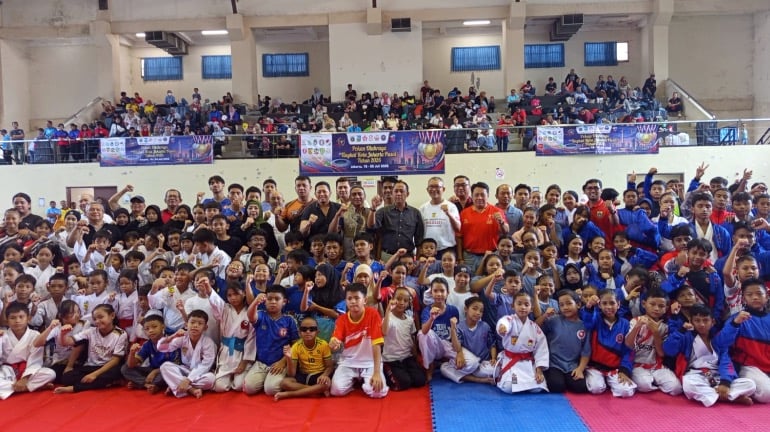
JAKARTA – A vibrant display of martial arts prowess unfolded at Gelanggang Olahraga (GOR) Benhil, Tanah Abang, on Saturday, July 25, 2026, as 345 karateka from various dojos and clubs across Jakarta Pusat converged for the Jakarta Pusat City Sports Week (Porkot) 2026 Karate Championship. This significant event is more than just a competition; it represents a cornerstone of athletic development and a vital scouting platform for emerging talent destined for the DKI Jakarta Provincial Sports Week (Porprov). The championship underscores the city’s commitment to nurturing a robust pipeline of athletes capable of representing the province on higher stages.
A Strategic Pillar in Athletic Development
The Jakarta Pusat City Sports Week, now in its 2026 iteration, has evolved into a critical component of the region’s sports prestasi (prestigious sports) development system. Rusdiyanto, Head of the Jakarta Pusat Youth and Sports Sub-Department (Sudin Pora), emphasized the strategic importance of Porkot, highlighting its role in systematically identifying and fostering athletic talent. This year’s edition of Porkot is particularly comprehensive, featuring competitions across 16 different sports disciplines, with karate being a prominent inclusion. The regional government’s unwavering support is a testament to its dedication to ensuring the smooth and effective progression of athlete development programs.
"This year, Porkot is showcasing 16 sports, and karate is one of them. The government is providing full support to ensure the athlete development process runs smoothly," stated Rusdiyanto. This comprehensive approach signifies a multi-faceted strategy to engage a broad spectrum of young athletes and provide them with structured pathways for growth.
Pathways to Elite Performance: From Porkot to POP
The Jakarta Pusat Porkot serves as a critical initial filtering mechanism, with a clear vision for the progression of its promising athletes. Rusdiyanto elaborated on the systematic approach to talent identification and development, outlining distinct pathways for athletes based on their age and performance.
For karateka under the age of 15, exceptional performance at the Porkot championships opens the door to the Program Pembinaan Olahraga Berkelanjutan (POPB), or Sustainable Sports Development Program. This program is designed to provide intensive, long-term training and support, focusing on foundational skills and holistic development for the youngest athletes.
More senior athletes, those who have demonstrated a higher level of maturity and competitive readiness, are earmarked for continuation within the Pusat Pelatihan Olahraga Pelajar (PPOP), or Student Sports Training Center. PPOP offers advanced training regimes, academic integration, and specialized coaching, preparing these athletes for the demands of provincial and national level competitions.
Furthermore, the championship awards certificates of achievement to its victorious participants. These certifications are not merely symbolic; they are practical tools that can significantly aid athletes in their pursuit of higher education through the Seleksi Penerimaan Murid Baru (SPMB), or New Student Admission Selection, utilizing a merit-based pathway. This integration of sports achievement with academic opportunities demonstrates a holistic approach to athlete welfare, ensuring that their development extends beyond the sports arena.
Fostering New Talent: A Focus on Emerging Stars
The strategic emphasis of the 2026 Jakarta Pusat Porkot Karate Championship, as articulated by Mulyanto, Chairman of the Central Jakarta Karate Association (FORKI Jakarta Pusat), was deliberately geared towards creating a fertile ground for the next generation of karate talent. To ensure that the competition genuinely identifies new prospects, a conscious decision was made to exclude karateka who have already represented DKI Jakarta at the provincial or national levels. This exclusionary criterion is pivotal in preventing seasoned athletes from dominating the competition and allowing emerging talents to shine.
"The main objective of this activity is to find new seeds who will later become the flagship athletes of Jakarta Pusat," Mulyanto affirmed. This clear mandate underscores the championship’s role as a talent incubator, prioritizing the discovery and nurturing of raw potential over the validation of established reputations. By focusing on this younger demographic, FORKI Jakarta Pusat aims to build a sustainable pool of athletes capable of contributing to the region’s sporting legacy for years to come.
Historical Context and Significance of Porkot
The Jakarta Pusat City Sports Week has a growing history, originating as a local initiative to foster sports participation and identify talent within the city’s administrative districts. Its evolution over the years has seen an expansion in the number of participating sports and a more formalized structure for athlete progression. The Porkot serves as a vital feeder system for the larger Porprov DKI Jakarta, which is the premier multi-sport event in the province, held biennially.
The Porprov DKI Jakarta itself has a rich legacy, dating back decades. It is where the province’s athletes showcase their skills, compete for regional pride, and earn their spots on national teams. Consequently, events like the Jakarta Pusat Porkot are not isolated competitions but integral stages within a much larger and more significant sporting ecosystem. The success of the Porprov directly correlates with the effectiveness of the grassroots development programs like Porkot.
Supporting Data and Trends in Karate Development
The participation of 345 karateka in this single championship in Jakarta Pusat provides valuable insights into the sport’s popularity and the depth of talent within the region. To contextualize this number, consider national karate participation figures. Indonesia has a significant presence in international karate competitions, with athletes consistently achieving medals in Asian Karate Federation (AKF) championships and contributing to the nation’s success at the Southeast Asian Games.
The growth of karate participation in urban centers like Jakarta Pusat is often driven by several factors:
- Accessibility of Training Facilities: The availability of dojos and sports halls, like the GOR Benhil, makes it easier for aspiring karateka to train regularly.
- School Programs: Many schools in Jakarta integrate martial arts, including karate, into their extracurricular activities, exposing students to the sport from a young age.
- Parental Support: With increased awareness of the benefits of martial arts for discipline, physical fitness, and self-defense, parental support for children’s participation in karate has grown.
- Role Models: The success of Indonesian karateka on the international stage provides aspirational figures for young athletes, motivating them to pursue the sport with dedication.
The demographic breakdown of participants at the Porkot, though not explicitly detailed in the initial report, typically includes a significant proportion of youth and junior athletes. This aligns with the stated objective of identifying "new seeds." The age categories are crucial for tailoring training methodologies and developmental programs, ensuring that each athlete receives appropriate guidance based on their physical and cognitive development.
Official Responses and Future Outlook
The statements from Rusdiyanto and Mulyanto reflect a coordinated effort between governmental bodies and sports federations to cultivate a thriving athletic environment. The commitment to "full support" from the local government is a strong indicator of the recognized value of sports in youth development and community engagement.
Looking ahead, the implications of this championship extend far beyond the medals and accolades awarded. The athletes who impress at the Jakarta Pusat Porkot will feed into the provincial-level selection processes, with the ultimate goal of representing DKI Jakarta at the Porprov. Success at the Porprov can then lead to opportunities at national championships and, for the most exceptional talents, international competitions.
The success of this initiative hinges on several factors:
- Sustained Funding and Support: Continued investment in sports infrastructure, coaching education, and athlete welfare programs is crucial for long-term development.
- Effective Talent Identification and Monitoring: Robust systems for tracking athlete progress and providing ongoing support are essential to prevent talent from falling through the cracks.
- Integration with Academic Pathways: Ensuring that athletes can balance their sporting ambitions with educational pursuits is vital for their holistic development and future careers.
- Community Engagement: Broadening the reach of such events and encouraging wider public participation in sports can foster a more active and healthier society.
The Jakarta Pusat Porkot 2026 Karate Championship, with its substantial turnout and clear developmental objectives, represents a significant step in solidifying Jakarta Pusat’s reputation as a hub for sporting excellence. It is an investment in the future, nurturing not only individual athletes but also the broader sporting landscape of the capital city and the nation. The echoes of the katas and the shouts of encouragement heard at GOR Benhil are the sounds of potential being realized and the promise of future champions being forged.