
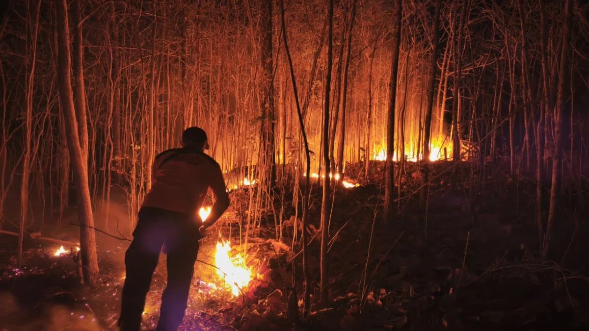
The National Disaster Management Agency (BNPB) of Indonesia has issued a critical warning regarding the resurgence of forest and land fires (karhutla) in Kalimantan. Despite recent rainfall, authorities report that the threat remains elevated due to the unique characteristics of peatland ecosystems, where smoldering embers persist beneath the surface, ready to reignite when conditions become favorable. As of early November 2026, the cumulative impact of these fires has reached 1,256 hectares across six high-priority provinces, prompting a massive mobilization of aerial assets and meteorological intervention strategies.
The Volatility of Peatland Fires
The current situation in Kalimantan Tengah (Central Kalimantan) and Kalimantan Timur (East Kalimantan) serves as a stark reminder of the challenges posed by peatland fires. Unlike conventional forest fires that consume surface vegetation and biomass, peat fires involve the combustion of organic matter that has accumulated over centuries. This organic layer can store heat for extended periods, even during intermittent rain.
Berton SP Panjaitan, Acting Head of the BNPB’s Data, Information, and Communication Center, emphasized the deceptive nature of the current containment. While surface visibility may suggest that fires have been extinguished, the reality is that the subsurface remains a tinderbox. "Considering these areas are peatlands, the surface fires may appear extinguished. However, smoldering embers remain underground, posing a significant risk of new forest fires breaking out," Panjaitan stated during a briefing on Tuesday, November 3, 2026. This phenomenon often leads to a cycle of false containment followed by spontaneous reignition, complicating the efforts of ground crews and monitoring teams.
Statistical Overview of the Current Crisis
Data released by the BNPB highlights a complex and shifting landscape of disaster response. Across the six primary provinces under observation, the total land area affected by fires has reached 1,256 hectares. However, the distribution of this damage is uneven, revealing rising trends in Kalimantan and a decline in other regions.
The most concerning developments are in Kalimantan Tengah, where the affected area has increased by 56%, totaling 547 hectares. Similarly, Kalimantan Timur has seen a sharp 80% surge, with 60 hectares currently under management. Conversely, efforts in Papua Selatan have seen progress, with a 25% reduction in affected areas, bringing the total to 455 hectares. In the Nusa Tenggara Timur region, fire suppression efforts have been largely successful, with the affected area dropping by 48% to 14 hectares. Meanwhile, Sulawesi regions, specifically Sulawesi Tenggara and Sulawesi Tengah, reported 91 hectares and 89 hectares respectively, with the latter showing a 4% decrease in fire activity.
Aerial Suppression and Strategic Intervention
In response to the escalating threats, the BNPB has deployed an extensive fleet of 51 aircraft and helicopters. This mobilization is split into two primary operational categories: 30 units dedicated to "water bombing" operations—the rapid deployment of large volumes of water onto active fire fronts—and 21 units utilized for aerial surveillance, patrol, and Weather Modification Operations (OMC).
The OMCs are a vital component of the Indonesian government’s strategy to combat the dry season’s impact. By seeding clouds with salt (NaCl) and dry ice, the agency aims to induce artificial rainfall over critical zones. The scale of these operations has been significant:

- Kalimantan Tengah: Six sorties have been conducted, utilizing 10,600 kilograms of seeding material. The operation successfully brought rainfall to key areas, including Palangka Raya, Sukamara, Katingan, East Kotawaringin, Seruyan, West Kotawaringin, Gunung Mas, and the Tanjung Puting National Park.
- Kalimantan Selatan: Over two days, two sorties were executed with 1,800 kilograms of NaCl. The resulting rain provided relief to Banjarbaru, Banjarmasin, Tanah Laut, and Tanah Bumbu.
- Sumatera Selatan: Four sorties were carried out using 5,600 kilograms of NaCl, which effectively brought rain to Palembang, Muara Padang, and Banyuasin.
Environmental and Economic Implications
The persistence of karhutla has far-reaching consequences beyond the loss of forest cover. The degradation of peatlands is a major contributor to carbon emissions. When peat burns, it releases vast amounts of stored carbon into the atmosphere, exacerbating regional air quality issues and contributing to long-term climate change.
Public health is the most immediate concern. The haze generated by these fires poses severe risks to respiratory health, particularly for vulnerable populations such as children and the elderly. Furthermore, the economic impact is multifaceted, affecting local agriculture, transportation, and tourism. The recurring nature of these fires underscores the necessity for long-term land management policies that prioritize the restoration and rewetting of peatlands. Without a permanent change in how these landscapes are managed—moving away from land-clearing practices that utilize fire—the cycle of suppression and resurgence is likely to continue.
The Challenges of Climate and Topography
The 2026 fire season has been influenced by fluctuating weather patterns, which have tested the effectiveness of disaster response strategies. While the government’s investment in weather modification technology shows promise, the physical nature of the terrain in Kalimantan remains a hurdle. Peatlands, by their very nature, are difficult to saturate fully. Once a fire reaches a certain depth, surface water often fails to penetrate the compacted, hydrophobic layers of dry peat, meaning that only heavy, sustained rainfall can effectively douse the underground embers.
The coordination between central authorities and local governments is currently being stress-tested. The success of the current mitigation efforts relies heavily on early warning systems and the rapid deployment of resources before a small brush fire evolves into a massive, uncontrollable peat fire.
Looking Ahead: Sustainability and Prevention
The BNPB’s current posture is one of "alert and readiness." Given the high potential for secondary fires, officials have advised local communities to remain vigilant. The agency is also focusing on long-term prevention through the maintenance of water canals and the monitoring of land-use permits in high-risk zones.
Experts note that while aerial suppression is essential for immediate crisis management, it is only a stopgap measure. True resilience against karhutla requires a multi-pronged approach: stricter enforcement of "no-burn" policies for agricultural expansion, community engagement in forest stewardship, and continued investment in hydrological restoration to keep peatlands sufficiently moist throughout the year.
As the year progresses, the monitoring of these 1,256 hectares will remain a top priority for the Indonesian government. The ability of the authorities to contain the fires before the end of the year will depend not only on the efficacy of the water bombing and weather modification efforts but also on the unpredictable nature of the monsoon season. For now, the "hidden fire" beneath the peat of Kalimantan serves as a reminder of the fragility of the ecosystem and the constant vigilance required to protect it from the threat of fire.