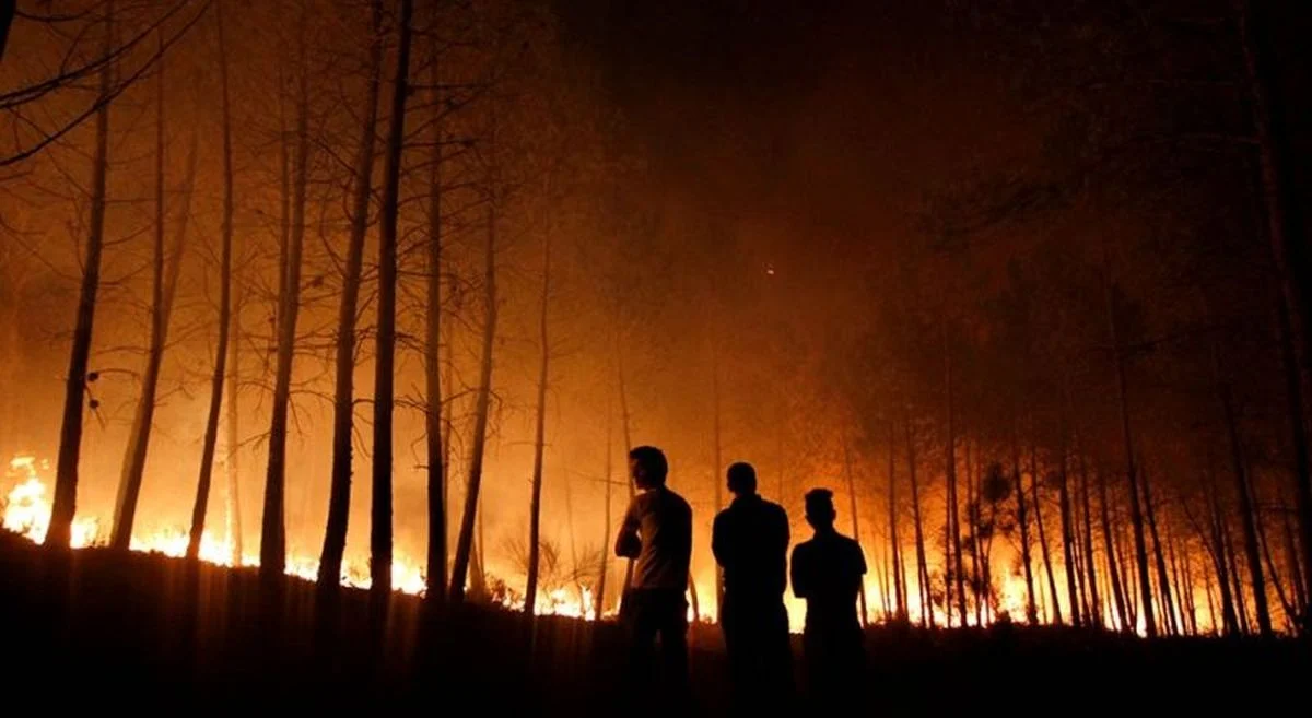
The ongoing forest and land fires (karhutla) engulfing the slopes of Mount Wilis, situated near Ngliman Village in the Sawahan District of Nganjuk Regency, East Java, have entered their fourth consecutive day as of Saturday, September 19, 2026. Despite the relentless efforts of a joint task force consisting of local disaster management agencies, forestry officials, and volunteers, the blaze continues to threaten the ecological stability of the region, hindered significantly by the rugged, high-altitude terrain that characterizes this volcanic landscape.
Chronology of the Incident
The fire was first reported on Wednesday, September 16, 2026. Initial assessments indicated that the ignition occurred in the vicinity of Petak 24, within the Gedangklutuk Forest Management Resort (RPH) under the Pace Forest Management Section (BKPH) of the Kediri Forest Management Unit (KPH). The dry conditions prevalent in late September, coupled with strong mountain winds, allowed the flames to spread rapidly through the underbrush and dry foliage.
By Friday, September 18, 2026, the situation showed signs of improvement in lower-altitude areas. Firefighters successfully extinguished the blaze located in Petak 47B, within the Kare RPH and the North Wilis BKPH. However, the relief was short-lived, as the fire front shifted upward toward the more inaccessible reaches of the Mount Wilis summit. The transition of the fire to higher elevations has complicated tactical planning, as traditional ground-based firefighting equipment is largely ineffective on the steep, rocky slopes.
Tactical Challenges and Mitigation Efforts
Berton SP Panjaitan, Acting Head of the Center for Data, Information, and Disaster Communication at the National Disaster Management Agency (BNPB), confirmed that the current strategy focuses on containment rather than direct suppression. Given the dangerous topography, ground crews have been ordered to establish "sekat bakar" or firebreaks—strips of land cleared of vegetation to prevent the fire from jumping to new sectors.
"The BPBD of Nganjuk, alongside our joint task force, is working under extreme pressure," stated Panjaitan in an official briefing. "Creating these firebreaks is our primary method of limiting the fire’s expansion. We are effectively trying to starve the fire of fuel before it can reach denser, more vulnerable sections of the forest."
In an effort to modernize the response, authorities have deployed drone technology, specifically agricultural spraying drones repurposed for fire suppression. These unmanned aerial vehicles are being utilized to reach hotspots that are physically unreachable by human crews. While drones cannot extinguish a massive wildfire on their own, they provide critical support by wetting down the periphery of the fire and cooling off hot spots, which slows the rate of spread and provides a safer environment for ground personnel to operate.
Environmental Context and Regional Impact
Mount Wilis is a critical watershed area for several regencies in East Java, including Nganjuk, Kediri, Tulungagung, and Madiun. The forest serves as a vital catchment area that sustains local agriculture and provides water to millions of residents in the surrounding plains. The loss of vegetation due to fire increases the risk of soil erosion and landslides, particularly as the region approaches the transition toward the rainy season.
The ecosystem of Mount Wilis, which hosts a variety of endemic flora and fauna, is highly susceptible to anthropogenic and natural fire risks during the peak of the dry season. Historical data on forest fires in the East Java region suggests that the period between August and October consistently sees a surge in thermal anomalies. Climate variability, specifically the influence of the Indian Ocean Dipole (IOD), often exacerbates these conditions by reducing humidity levels in the mountainous regions of Java.
Economic and Societal Implications
The economic impact of the Mount Wilis fire extends beyond the immediate loss of timber and brush. For the local Nganjuk community, particularly those in the Sawahan District, the mountain is a hub for eco-tourism and small-scale agriculture. The smoke haze generated by the fire has prompted local health authorities to issue warnings to residents to wear masks and limit outdoor activities to prevent respiratory distress.
Furthermore, the allocation of state resources to combat these fires represents a significant fiscal burden. The deployment of joint personnel, the maintenance of fire-suppression equipment, and the logistical requirements of operating in a remote mountain range require substantial coordination between the provincial government, the Indonesian Military (TNI), the National Police (Polri), and local volunteer groups.
Comparative Analysis of Fire Management
The difficulties faced in Nganjuk are emblematic of the broader challenges Indonesia faces in forest fire management. While the central government has made significant strides in monitoring hotspots via satellite imagery—such as the SIPONGI system—the "last mile" of firefighting remains a persistent hurdle.
Experts in forestry management note that mountainous fires differ fundamentally from peatland fires, which are common in Sumatra and Kalimantan. While peatland fires require deep-well pumping and massive water bombing, mountain fires require high-mobility teams and logistical precision. The reliance on manual labor to dig firebreaks remains the most reliable, albeit slow, method of suppression in high-altitude terrain.
Future Outlook and Official Response
As of late Saturday, the situation remains fluid. Meteorological reports for the Nganjuk region indicate low humidity and continued moderate winds, suggesting that the risk of the fire reigniting or expanding remains high. Authorities have maintained a state of high alert, with additional personnel on standby to monitor for potential spot fires caused by embers carried by the wind.
The BNPB has urged the public to refrain from activities that could spark further fires, such as clearing land by burning or discarding cigarette butts in forested areas. "The forest is currently at its most vulnerable state," Panjaitan noted. "Even a small spark in these conditions can lead to catastrophic consequences. We urge all stakeholders and local communities to exercise maximum vigilance."
Moving forward, the regional government is expected to conduct a comprehensive post-fire assessment to determine the total hectarage burned and to initiate reforestation efforts once the danger has fully passed. The restoration of the Mount Wilis ecosystem will be a long-term project, necessitating a collaborative approach between the Ministry of Environment and Forestry (KLHK), local administrations, and environmental conservation NGOs to ensure that the mountain regains its function as a stable water tower for East Java.
In the short term, the joint task force will continue to prioritize the protection of residential areas and agricultural zones surrounding the base of the mountain, while attempting to encircle the remaining active flames at the summit. The resilience of the Mount Wilis landscape will be tested in the coming weeks, as the authorities work to bring this persistent threat under control.